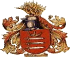
Middlesex County coat of arms (pre 1965)
MIDDLESEX
A summary of Tim Silver’s links with Middlesex
Middlesex is where I, my parents, a grandparent and four gt. grandparents were born. It is also the county where the last three Silver generations have been buried / cremated. What more can I say?
Main areas of interest:
Extended family locations:
Acton: Bedfont: Brentford: Chelsea: Clerkenwell: Ealing: Earlsfield: Fulham: Greenford: Hampstead: Hanworth: Hayes: Isleworth: Islington: Kensington: Kew: Kingston: Lambeth: Northfields: Notting Hill: Old Brentford: Putney: Richmond: Shepherds Bush: Staines: Sunbury: Teddington: Twickenham: Upper Teddington: Uxbridge: Whitton
Middlesex (abbreviated Middx) is one of the 39 historic counties of England and the second smallest by area. The low-lying county contained the wealthy and politically independent City of London on its southern boundary and was dominated by it from a very early time. The county was significantly affected by the expansion of the metropolitan area of London in both the 18th and 19th centuries, such that from 1855 the south-east was administered as part of the metropolis. When county councils were initially introduced in England in 1889 about 20% of the area of Middlesex, along with a third of its population, was transferred to the County of London, and the remainder formed a smaller county, in the north-west, under the control of Middlesex County Council.
In the interwar years urban London had further expanded, with increasing suburbanisation, improvement and expansion of public transport, and the setting up of new industries outside the inner London area. After the Second World War, the population of the County of London and inner Middlesex was in steady decline, with new population growth only experienced in the outer suburbs. After a Royal Commission on Local Government in Greater London, almost all of the original area was incorporated into an enlarged Greater London in 1965, with small parts transferred to neighbouring Hertfordshire and Surrey. Despite the disappearance of the county council, Middlesex is still used as an area name and was retained as a postal county; which is now an optional component of postal addresses.
The name means territory of the middle Saxons and refers to the tribal origin of its inhabitants. The word is formed from the Anglo-Saxon, i.e. Old English, ‘middel’ and ‘Seaxe’. Its first recorded use was in 704 as Middleseaxan.
There were settlements in the area of Middlesex that can be traced back thousands of years before the creation of a county. The first reference to the region under the name of Middleseaxon is in a charter giving the Bishop of Waldhere Twickenham. This was nearly 200 years before the official creation of the counties of England in 900 A.D.
Middlesex was recorded in the Domesday Book as being divided into the six hundreds of Edmonton, Elthorne, Gore, Hounslow (Isleworth in all later records), Ossulstone and Spelthorne. The City of London, which has been self-governing since the thirteenth century, was geographically within the county, which also included Westminster, which had a high degree of autonomy. Of the six hundreds, Ossulstone contained the districts closest to the City of London. During the 17th century it was divided into four divisions, which, along with the Liberty of Westminster, largely took over the administrative functions of the hundred. The divisions were named Finsbury, Holborn, Kensington and Tower. The county had parliamentary representation from the 13th century. The title Earl of Middlesex was created twice, in 1622 and 1677, but became extinct in 1843. ©Wikipedia
The county lies within the London Basin and the most significant feature was the River Thames, which formed the southern boundary. The River Lea and the River Colne formed natural boundaries to the east and west. In the south west of the county, the Thames meandered enough to make ‘Middlesex bank’ more descriptively accurate than ‘north bank’; a distinction used during the The Boat Race. In the north the boundary was mostly formed by a ridge of hills broken by Barnet valley and a long protrusion of Hertfordshire into the county. The county was thickly wooded, with much of it covered by the ancient Forest of Middlesex. The highest point was the High Road by Bushey Heath at 502 feet (153 m), which is now one of the highest points in London. ©Wikipedia
Ashford, 51°26'N 0°27.8'W, is a town almost entirely in the Surrey borough of Spelthorne in England, with a small part falling within Greater London. It is a suburban development situated 15 miles (24 km) west south-west of Charing Cross in London and forms part of the London commuter belt.
It is often referred to as Ashford, Middlesex to distinguish it from the larger town of Ashford, Kent, because it fell within the historic county of Middlesex. Since 1965, when Middlesex County Council was dissolved, it has been part of Surrey and the small London section part of the London Borough of Hounslow. ©Wikipedia
My links with Ashford couldn’t be stronger. I was born in Ashford (at my god-mother’s). My father, James Wilfred Silver and my mother, Nancy Andrews were both born in Ashford. My parents married at St Matthew’s church in Ashford. The church figures strongly as I was both baptised and confirmed there. In addition, two of my mother’s siblings were also married in this church.
Feltham, 51°27'N 0°24.2'W, formed an ancient parish in the Spelthorne hundred of Middlesex. In 1831 it occupied an area of 2,620 acres (11 km2) and had a population of 924.
From 1894 to 1904 the Feltham parish was included in the Staines Rural District. In 1901 the parish had a population of 4,534 and in 1904 it was split from the rural district to form the Feltham Urban District.
In 1932 the parishes of Hanworth and East Bedfont were also transferred from the Staines district to Feltham Urban District. The former area of Feltham Urban District became part of Greater London in 1965 as part of the London Borough of Hounslow.
Links with Feltham start with my gt. grandfather, James Thomas Silver. He was the Silver (in my direct line) that left the land and Hampshire. I say that my links with Feltham end with James because while he moved lock, stock & barrel with his wife and 10 children, I've not, so far, been able to trace any surviving members. (Quite a few ‘extended family’ members also resided in Feltham)
Hammersmith, 51°31'N 0°13.3'W, is an urban centre in the London Borough of Hammersmith and Fulham in west London. It is bordered by Shepherd’s Bush to the north, Kensington to the east, Fulham to the south and Chiswick to the west, and is linked by Hammersmith Bridge to Barnes in the southwest.
Hammersmith features in Charles Dickens ‘Great Expectations’ as the home of the Pocket family. ©Wikipedia
The exact reason why my gt. grandfather, Albert Edward Hyman, cycled all the way from Stanwell to Hammersmith in the early 1890’s (on a daily basis as I was once told), is not clear; some said it was something to do with a fish-monger while others, a butcher. Whichever, I’m guessing that’s the area where Albert met his future wife, Phoebe Knight. They had a ‘liaison’ and their 1st born was illegitimate but they soon later married. There must have been something between them - they had 17 children!
Hampton, 51°25'N 0°22.2'W, is a suburban area, centred on an old village on the north bank of the River Thames, in the London Borough of Richmond upon Thames in England. Formerly it was in the county of Middlesex, which was also its postal county.
The population is about 9,500. The Anglo-Saxon parish of Hampton included present-day Hampton, Hampton Hill, Hampton Wick and Hampton Court which together are called The Hamptons.
The name Hampton may come from the Anglo-Saxon words ‘hamm’ meaning an enclosure in the bend of a river and ‘ton’ meaning farmstead or settlement.
The riverside, on the reach above Molesey Lock, has many period buildings including Garrick’s House and Shakespeare’s Temple, also on the river is the Astoria Houseboat recording studio. Hampton Ferry used to provide access across the Thames to East Molesey. ©Wikipedia
The family names associated with this area come from my mothers side (if you’ve read the ‘Hyman’ family page you’ll know there’s some doubt about the significance of this entry) and the most predominant are Johnson and Fricker. My 2x gt. grandmother, Eliza Ellen Johnson was born at Hampton Court - although not in the palace. Her mother, Eliza Ellen Fricker (yes, their first names were the same) was born in Hampton Wick.
Stanwell, 51°27'N 0°28.3'W, is a suburban village in the Surrey borough of Spelthorne. It is located 15.7 miles (24.8 km) west south-west of Charing Cross and half a mile (0.8 km) from the southern boundary of London Heathrow Airport and the London Borough of Hillingdon.
There are two theories regarding the origin of the name Stanwell. One is that it was named after St Anne’s Well in the village. The second, and more likely, theory is that it in fact means ‘stone well’. The first few letters of the name are the same as in the name of neighbouring Staines, which also is said to mean ‘stones’.
Stanwell appears in the Domesday Book of 1086 as Stanwelle. It was held by Walter, son of Othere. ©Wikipedia
Statistically, my predominant link with Stanwell is the Hyman’s. In 1851 my 2x gt. grandfather, William Hyman, was in Mells, Somerset. Around the mid 1850’s he’s migrated east and, having met Elizabeth Grooves/Wooderson, he settles in Stanwell and they marry in Stanwell on 09 Oct 1859.
From the early 1930‘s, Albert and family lived in a small-holding at the end of Spout Lane (about 150 yds. from Heathrow south runway. Spout Lane was effectively cut-in-half by the A3044 and the eastern half (where Albert lived) is now under Heathrow T5.
(Ignoring the statistics, I spent the first 4 years of my life in Stanwell.)
© Tim Silver | Hosted by Glenndilen Digital